The KAPtery closed on December 31, 2024. Products can no longer be ordered from these pages. Some products are available for purchase from Ennapurna in France. For questions, replacement parts, special requests, or leftover inventory, use the Contact page above.
SkyPod GPS logger
My favorite KAP camera for the past few years has been the Canon PowerShot S100. It has an integrated GPS receiver and I routinely had it attach GPS location data to each photo. Recently I have been flying a much better camera, the Canon EOS M, to exploit its bigger sensor and much better lens. But the EOS M does not have GPS. I listed these things you can do with GPS data from KAP flights in a post here.
- Some structure from motion software (makes 3D models from photos) requires that photos have GPS data in the EXIF header.
- Some structure from motion software works faster or scales the final 3D model if GPS data are present in the photos.
- Some orthophoto mapping software can georeference the stitched image if GPS data are present in the photos.
- Mapknitter and Google Earth will automatically place photos if they contain GPS data.
- The track followed by the flying camera can be displayed in three dimensions, possibly with other data collected.
- You can learn how high the camera was.
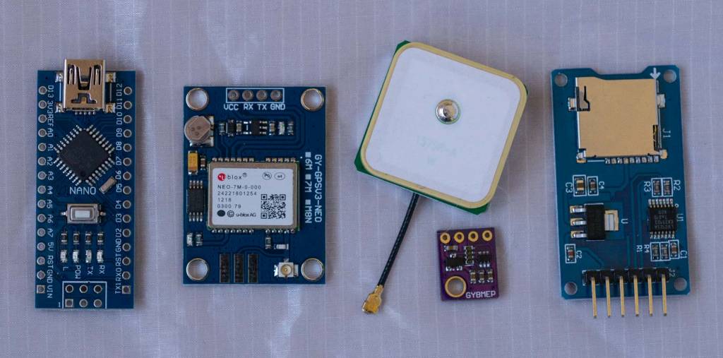 |
| These electronic components can be soldered together to make a device which records GPS location and barometric pressure to a microSD card. |
I have not flown the SkyPod on a KAP rig yet (two attempts had inadequate wind), but it has proven itself in lots of terrestrial tests. I am eager to fly it on the next good day. I bought some extra components and made a few kits which can be assembled into SkyPods. These kits require a few hours of soldering, but have everything you need to start collecting GPS location data during kite or balloon photography flights.
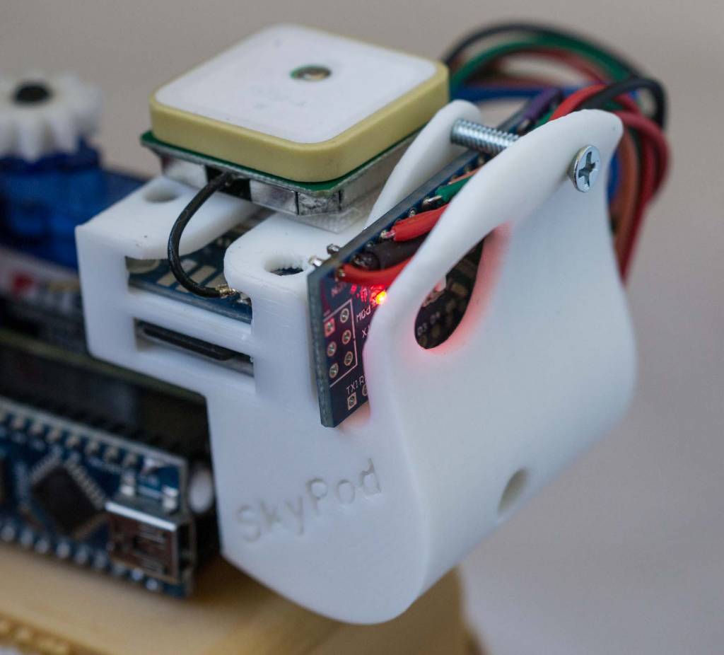 |
| The SkyPod Kit will build this GPS logger shown riding on the shoulder of a Saturn V Rig. |
Stay tuned for reports of the first SkyPod flight. It should be very soon.
